2 Cool Fishing Forum banner

West Bay and San Luis Pass

12K views 25 replies 18 participants last post by  bd24  
#1 ·
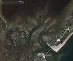
Couple of questions. Some friends have rented a house just inside the pass next week. I'm dragging the boat down to fish with them. 24 Seahunt BXBR/300Yamaha. All my bay fishing is in East and Trinity, I know West is shallow and my big boat isn't so skinny(i do have a hydraulic jackplate but she runs fairly deep). The house is right on Cold pass. Areas to avoid? General areas to fish? Also I do run offshore quite a bit out of Galveston and Freeport, Can I safely go out through San Luis Pass into the gulf? Or should I run the ditch to either Galveston or Freeport and then out?
Thanks
 
#2 ·
Go real slow and study the goggle satellite imagery to get just an idea where the sand bars may be (they move) and where not to go. If it's the camp house on the west shore of coldpass, there a lot of water in front once you are around the sandbar in the middle of coldpass. You can go out coldpass, mind the bridge clearance and stay to the Galveston Island beach side channel. Up and along the shore line towards bird island is deep, with your rig don't go much passed Bird Island on the shore line. South of bird island is a deep channel as well, private aids mark the channel (slow is the game until you know).
 
#3 ·
You are going to have big problems getting around in that area-You have to really be familiar how to work your way around & it changes all the time-Once you get under the bridge & out in the gulf you are pretty much good but from the bridge into west bay it is tough-I would go get a map of the area & study it carefully-Be careful & good luck-Positive thing is there are some good fish in that area.
 
#4 ·
Like they said, SLP and cold pass is where a lot of groundings happen. Not trying to scare you, but by all means take your boat and give it a try. Like they said, use google earth and study the channels. Coming out of SLP into West Bay, there are markers that start just south of bird island. Stay on the left of those markers going out, and staying on the right coming in. Once you get out of that last marker into the bay it's pretty much open water and 7-8ft deep until you around Carancuha reef. Cold pass doesn't have any markers, but I'll try to draw a line on google earth to show you where to go.
 
#5 ·
Google Earth

So I did my best to draw some lines to show you some channels from MY knowledge

Black- This is that channel that I said is marked with poles that leaves from SLP into the West Bay. I run this channel about every weekend so I know that one is right..

Green- This is the track I use to get through Cold Pass. Do keep in mind that on my track it does get around 2ft on a low tide where I circled that part in purple. I basically run that track through Cold Pass, hang a left into Churchill Bayou, and go out into Christmas Bay.

Yellow- From what I'm reading, you have no need to run this track, I just drew it for future reference.

Red- I wouldn't 100% rely on this track I drew, as I've never ran that way. But looking at Google Earth it looks like a channel to me. If you're going offshore through SLP I'd get somebody else to review this track and make sure it's right.
 

Attachments

#6 ·
That red line takes you through the middle of he77....avoid that beach break.

Green-after you come out of the county park area and head left stay against the piers and you need to stay up against the grass on SLP island. And then bear a heading toward the big pier and turn at the pier toward Churchill Bayou. If you stay in Green middle without hugging the grass you will visit Poons bar in a bad way.

Don't even think about yellow north of bird island.
 
#7 ·
That red line takes you through the middle of he77....avoid that beach break.

Green-after you come out of the county park area and head left stay against the piers and you need to stay up against the grass on SLP island. And then bear a heading toward the big pier and turn at the pier toward Churchill Bayou. If you stay in Green middle without hugging the grass you will visit Poons bar in a bad way.

Don't even think about yellow north of bird island in your boat.
 
#8 ·
I'd also avoid Churchill feed into Christmas. On the wrong tide or wind, you're running on spit. I'd suggest you take cold pass east towards the bridge and go stupid slow. Hero to zero in no time flat. Tough place to learn new water, but a great place to fish. Have fun, be safe, and make sure to have everyone in PFD's at all times.
 
#9 ·
Man, you guys are awesome, keep it coming. I,ve fished some of this area in kayak(cold pass near the long pier on east side , the flats on Galvez side in front of Point west, tit/tat, etc.) between boats ownership. I just remember more than 10 years ago running my previous bay boat around cold pass and Christmas with lots of surprises and occasional grounding
 
#12 ·
Use the history slider in Google earth for areas that change often. Find a clear water aerial.

I even take is slow in that area.. still pucker a little even. Best advise is do an afternoon late morning or mid day run out of Colds with clear water and good sun and you can pretty much read the color of the depth. The main cut out to the bay has a couple of PVC pipes but they might not mean anything to someone running it first time.
 

Attachments

#13 · (Edited)
You shouldn't have any issues headed NW through the pass, but coming out of the KOA hug the west wall and then cut it hard to the NW towards bird island, that sand bar comes WAY out - a straight path north (the yellow shown) is going to put you on the sand bar.

Once you headed off the island to the NW the cut is VERY well marked with tall orange/white poles, you'll make a big s-turn to the final pole that has a green marker on it and you should be out safe.

I would avoid the green track pictured to some extent. Heading to Christmas, hug the south shore coming out of the houses and then start turning hard north past the long pier. Stay LEFT and then make the corner into Christmas, you should be safe from there. Don't get me wrong, you can get through Oilman's without an issue but getting OUT into Christmas might be sketchy ...
 
#16 ·
That red line will get you in trouble fast. Stay close to the Galveston side of the pass after you go under the bridge. Turn left and follow the shoreline for at least a mile before you head out offshore. That sandbar is a beast and is always changing.


Sent from my iPhone using Tapatalk
 
#18 ·
I agree Jim, Google Maps 'aerial' shot is only the current satellite view, not necessarily the best image to look at... use Google Earth, then use the history slider to find a clear water aerial. The one above is the most recent clear water aerial march 2015.

DK2429 is correct.. for Colds Pass to Christmas.. Churchill Bayou is better route than running Colds all the way into Christmas. In Churchill the channel in Christmas is well marked. If you need to slow off plane to make sure you stay in it.. do so.. its' a couple feet deep and mud.. but don't miss, there is shell both sides of it.
 
#22 ·
Stay away from the red line because there is usually a sandbar that extends from the Freeport side to the middle of the pass on the Gulf side after you pass the bridge. You can usually see the white caps in that area. The channel hugs the Galveston side until you reach open water. That's what I have observed over the years. I haven't been there in a while and the bottom at SLP changes over time so be careful.